
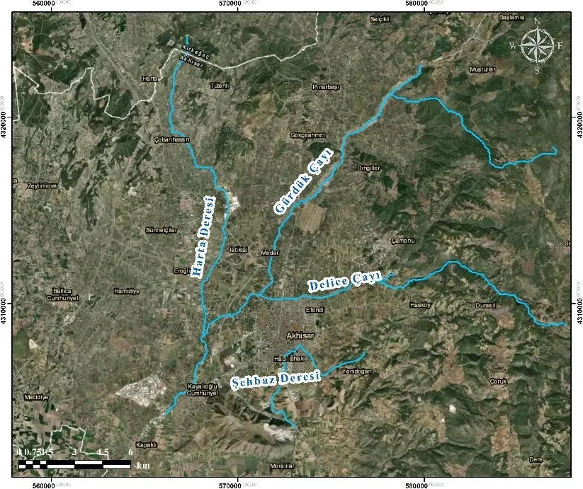


The project focuses on a detailed assessment of the flood regime in the Gürduk, Delice, Merkez-Şahbaz and Harta stream basins located within the Akhisar district. Within this scope, hydrological characteristics of the catchments, rainfall–runoff relationships and design flood discharges with different return periods are determined and used as input for hydraulic modelling.
Using digital elevation models and available cross-section data, one- and two-dimensional hydraulic models are established to simulate flood propagation for design discharges such as Q50 and Q100. Flood extents, water depths and flow velocities are calculated, and flood hazard and risk maps are produced. Based on these outputs, potential impacts on settlements, infrastructure and agricultural areas are evaluated and priority risk zones are identified.
Both structural measures (channel improvements, levees, flood relief and regulation structures, cross-section optimization, etc.) and non-structural measures (early warning systems, land-use planning, definition of flood corridors, emergency planning) are proposed, resulting in an actionable Flood Risk Management Plan for Akhisar Municipality. The project contributes to reducing flood damages, improving public safety and developing a climate-resilient water management strategy for the region.